Ascent of Taulliraju 5,830m Andes of Peru, by Tomeu Rubi and Cati Lladó
Cordillera Blanca Expedition, Peru
Text and photos by Tomeu Rubi
After a few weeks in the mountain range Blanca, Peru, where we climbed the Nevado Urus and the Tocllaraju, as well as some rock climbing in the Quebrada Rúrec to acclimatize, we decided to look for a more technical ascent. There are several options that we had evaluated from home. We have been able to verify that most of the snowfields are short of snow (some villagers tell us that every year the temperatures are higher…) and that most of the routes we had assessed may not be in good condition.
On a visit to the guide office in Huaraz, when we discuss our intentions, they tell us that a group of Argentines (A. Perez, T. Odell, P. Odell and P. Navarro) have climbed the Taulliraju. Good news!!! So it’s one of those mountains that when you see it, it stays etched in your mind and this image had already settled on my short hard drive for months.
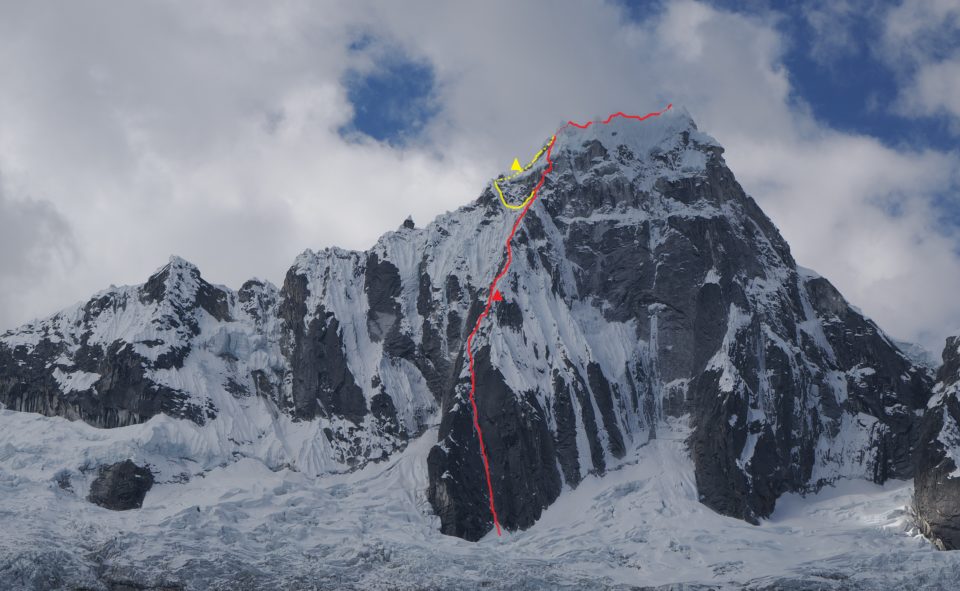
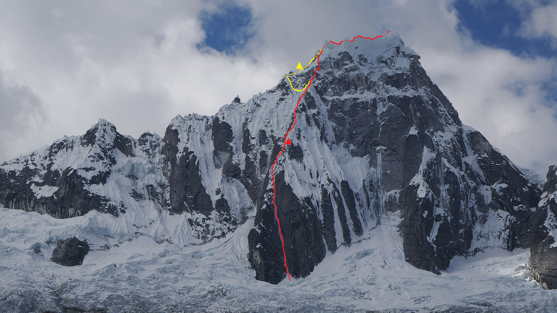
In red, Italian route from 1980. In yellow, variant that we made.
It has no easy ascent routes, nor does the descent seem quick and easy. We manage to talk to the Argentines who very well give us some details of the route.
The chosen route is the Espolón O of the SW face, which was climbed for the first time by an Italian team made up of G. Calgano, P. Perona, U. Vialardi, C. Piazzo, T. Vidoni, and S. De Benedetti in 1980.
Jeff and Alex Lowe repeated it in 1983 in alpine style. S. House and M. Prezelj released the route in 2005. There appear to have been no further ascents of this route before 2023.
Ascension to Taulliraju
On the 6th of August we woke up around 03:30 in our small camp near Punta Unión. Pep Roig, who was supposed to be the third member of the team, decided to resign at the last moment. We has to quickly reorganize the material and the food to adapt it to a team of two formed by Cati Lladó and myself.
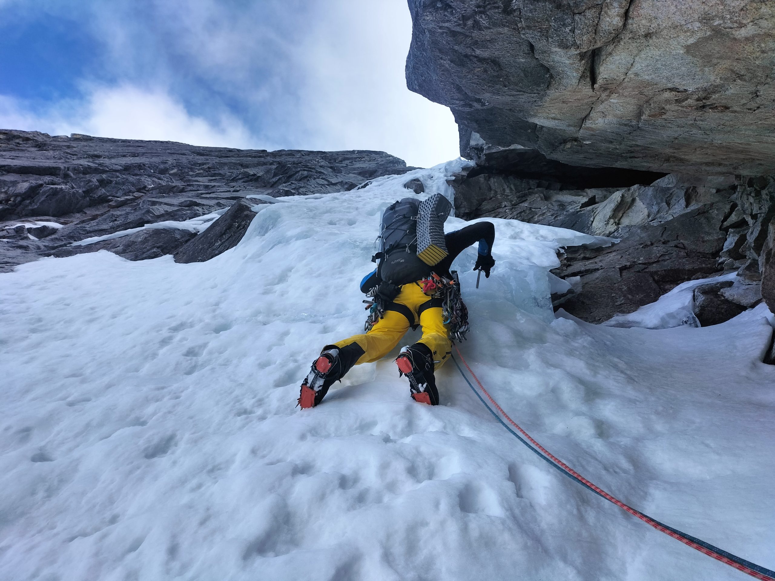
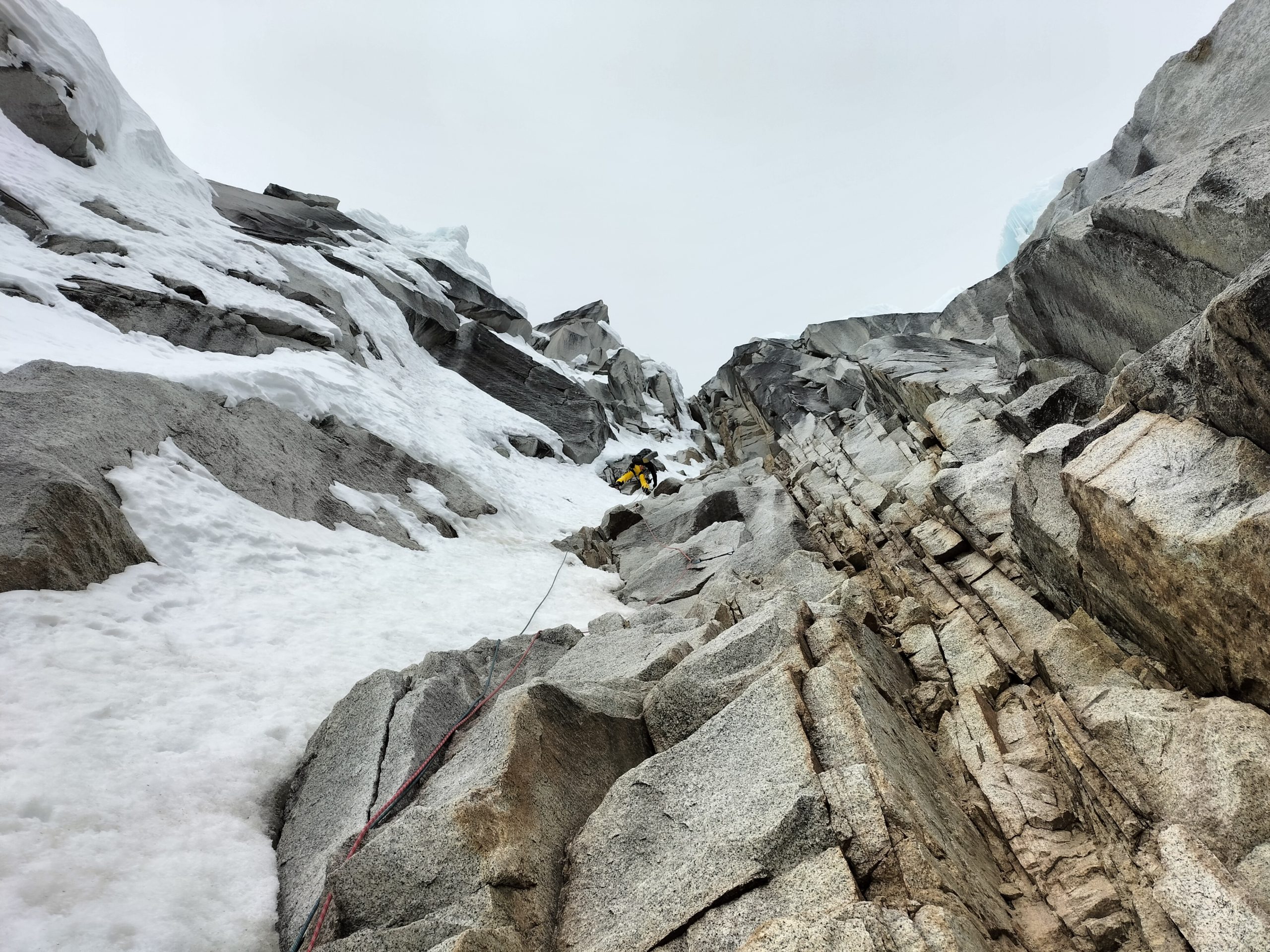
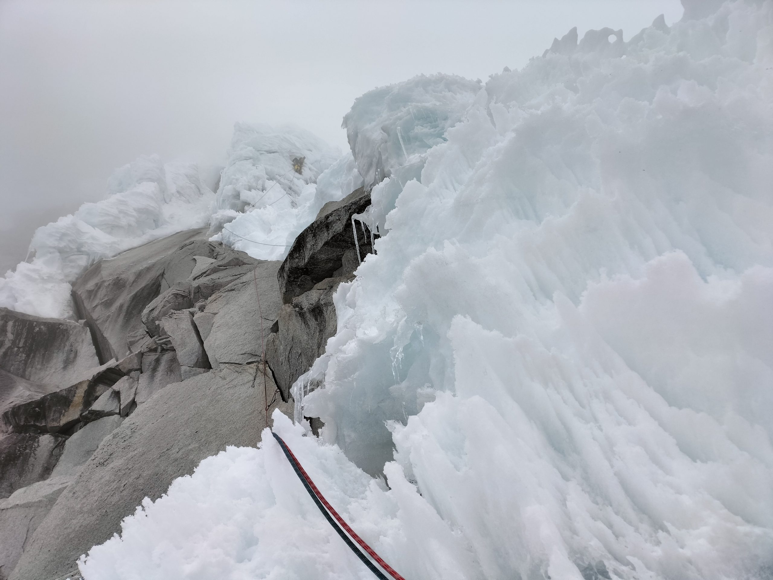
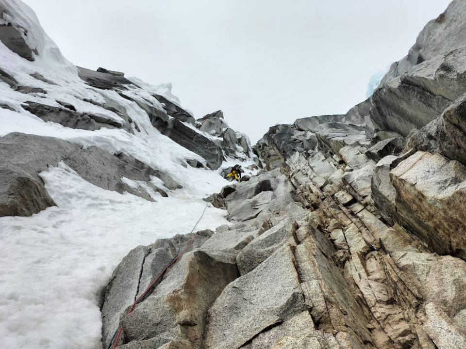
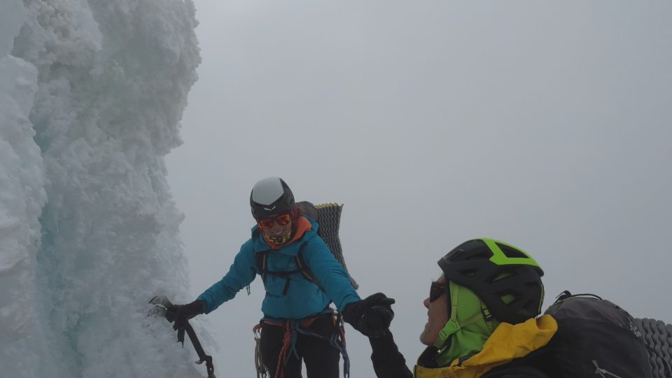
We had breakfast and around 04:30 we set off. The previous afternoon we calculated that in about two hours we could be at the foot of the corridor, where the climbing really begins. We did not expect that this morning the clouds would be so low, this is a problem since we have been in Peru, where the clouds have only appeared in the afternoons and we have barely seen precipitation. Could it be that the weather has started to change because the season has already advanced…? In any case, we go up hoping that the clouds will dissipate and we will have no problems crossing the lower part of the glacier, full of crevasses, which gives access to the route. With a bit of luck we find the right path and around 06:30 we are at the beginning of the difficulties. It is not very cold and we progress quickly on the first length. About 400m further up, the corridor ends and we access the spur through a stretch of M6. From here the playing field seems to change, it’s still a combination of ice and rock, but now the ice forms fungi suspended in precarious balance, which you have to sort through to find the safest route to progress in a terrain where the protections we have put in place are many times more psychological than safe. Luckily the meetings do tend to be solid.
-

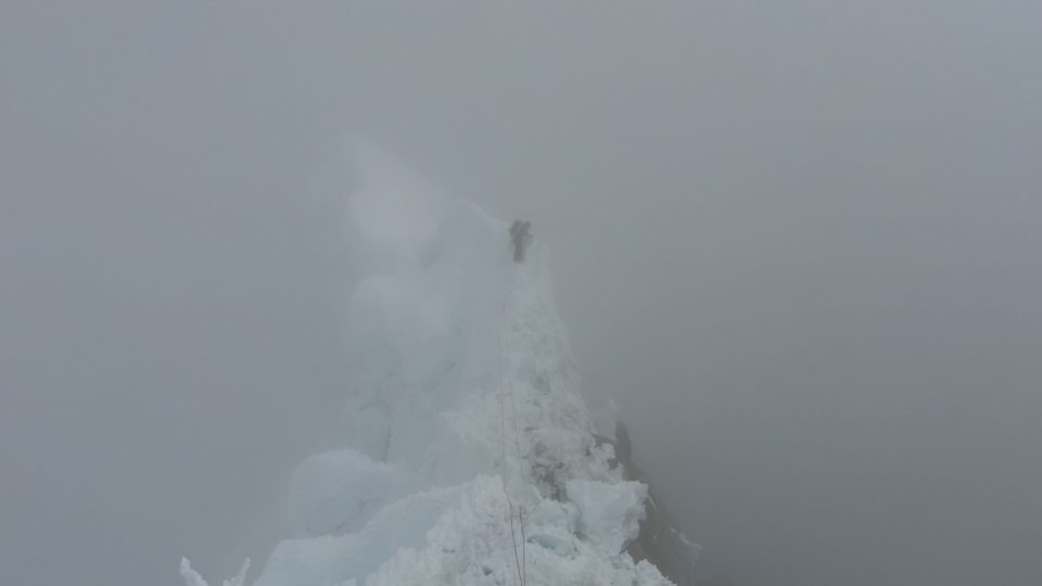
- Start of the route
-
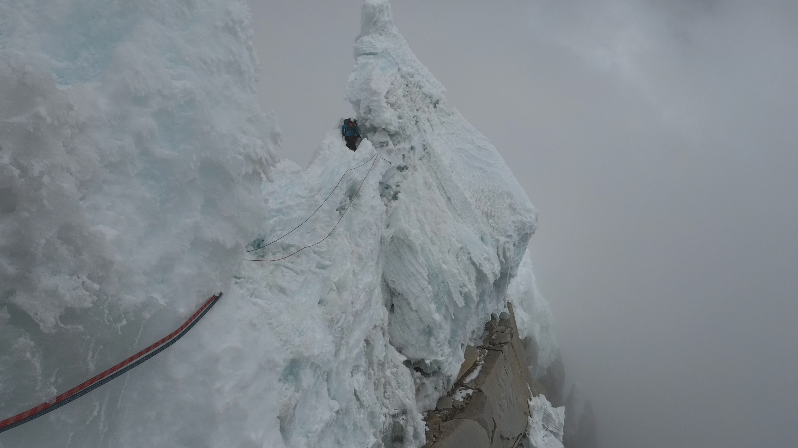
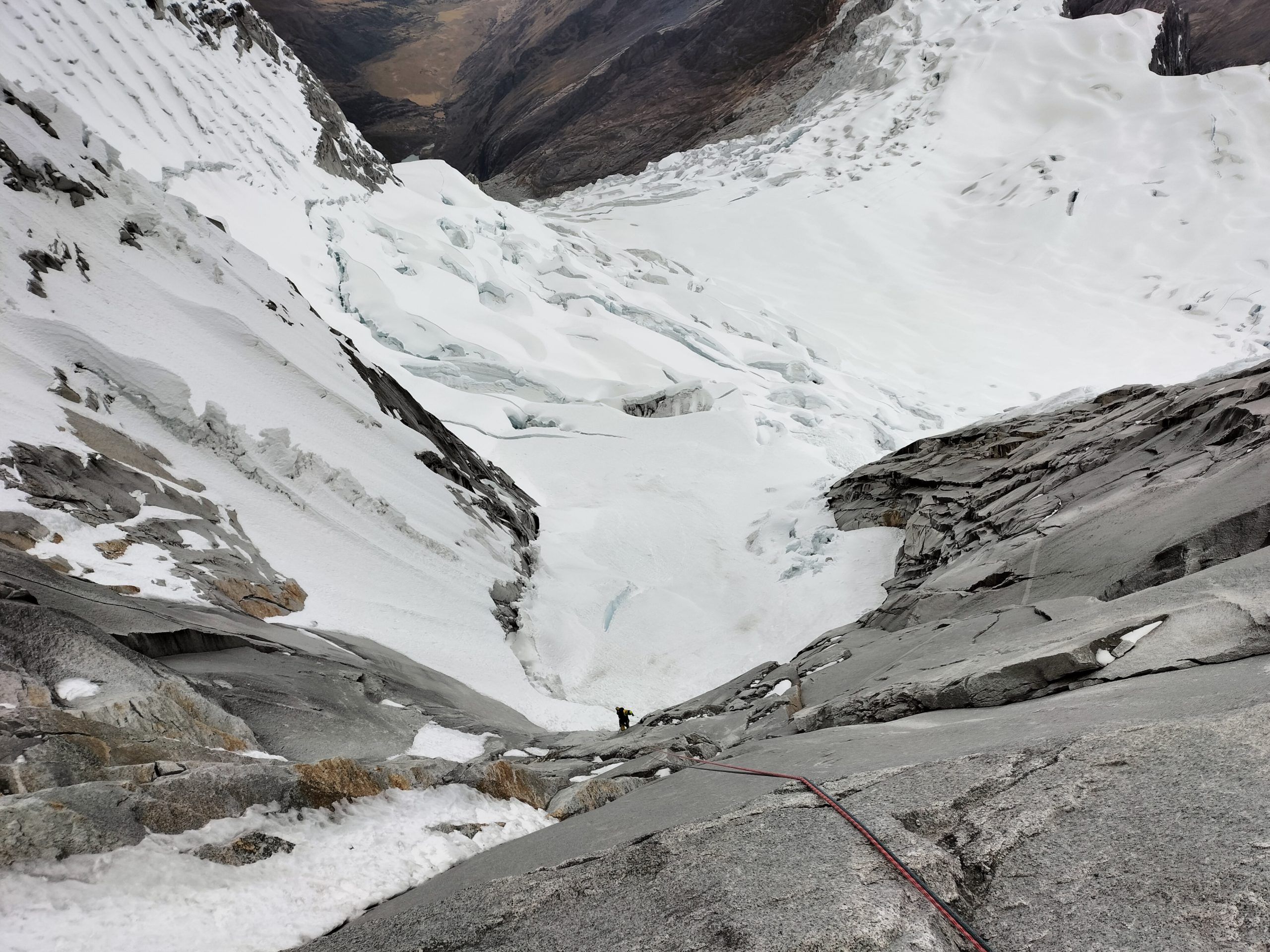
- Upper part of the entrance hall
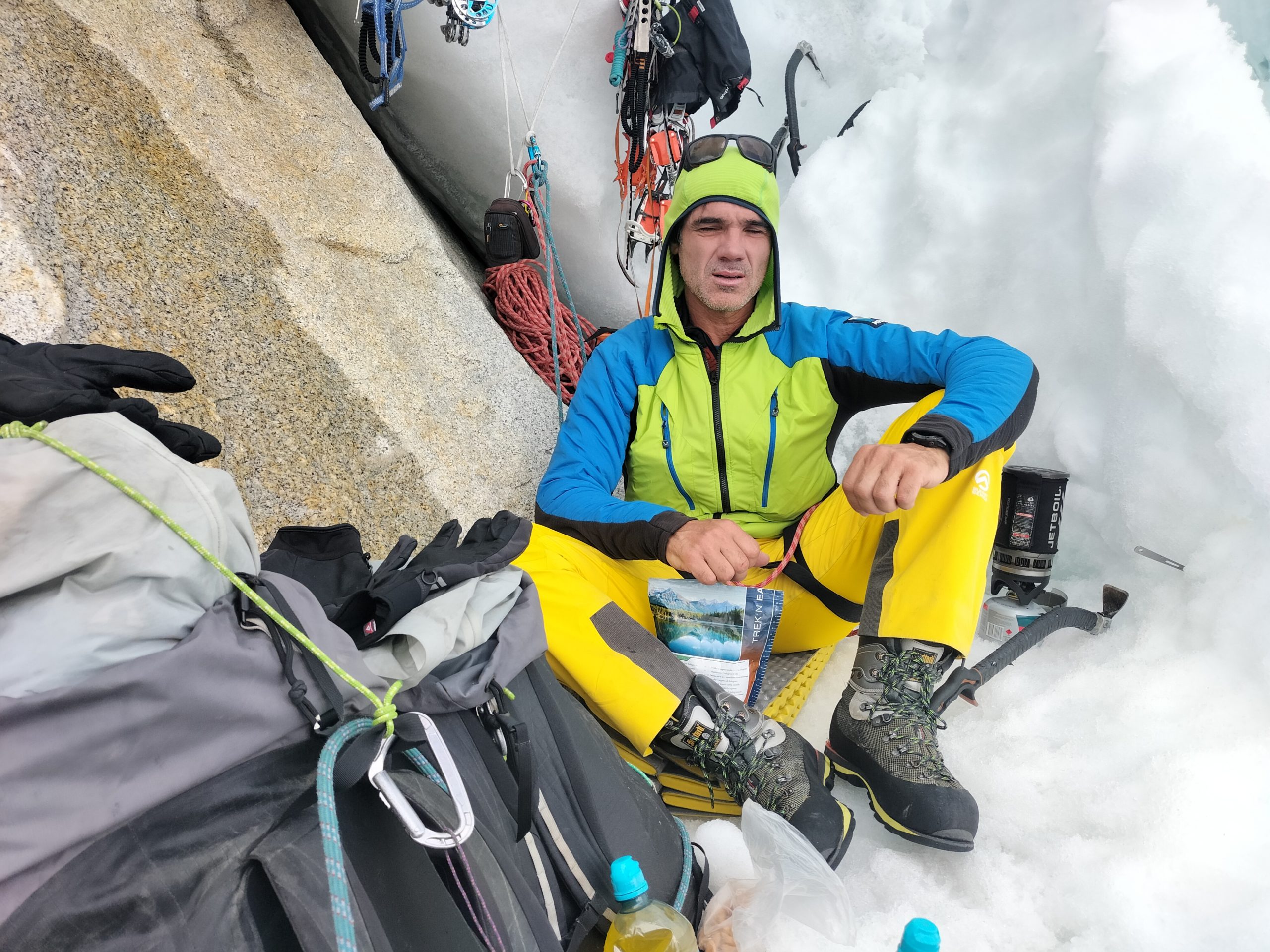
Since we started climbing, the clouds have dissipated at times and this has allowed us to progress relatively quickly. At 2:00 p.m. we will arrive to the point where the Argentines spent the night about 10 days ago. We think about continuing to climb to take advantage of the remaining hours of daylight (about 4). Since the clouds do not cease in their desire to envelop us and in the face of the doubt as to whether we will find somewhere to spend the night in a reasonable way, we decide that today we will sleep here, taking advantage of the work done by our Argentine colleagues. Around 19:00 it starts to snow, we didn’t carry a tent to go light, tonight even if we use our bivouac covers, our bags will start to accumulate moisture which will decrease the volume of the feather and therefore its power of isolation.
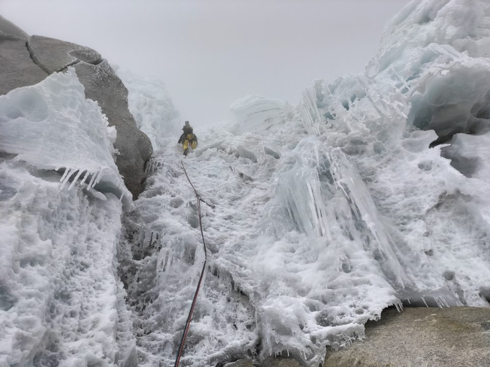
-
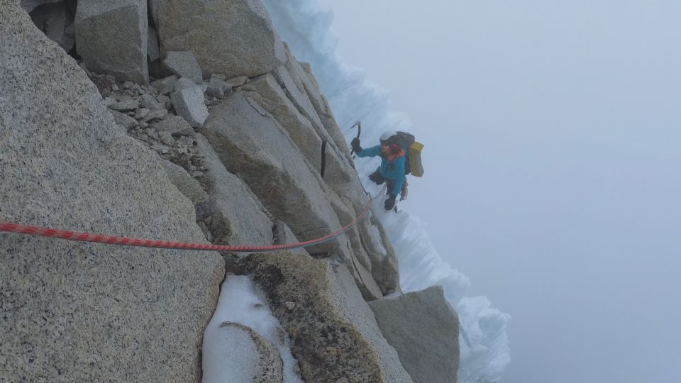
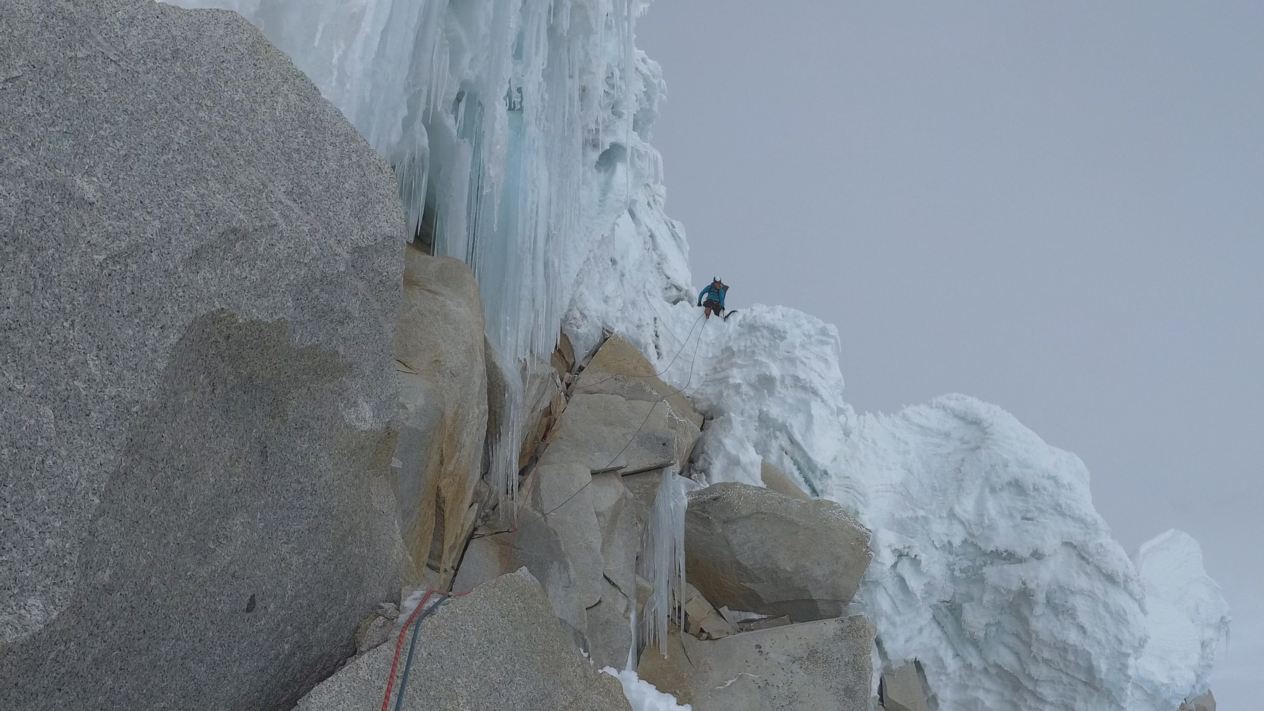
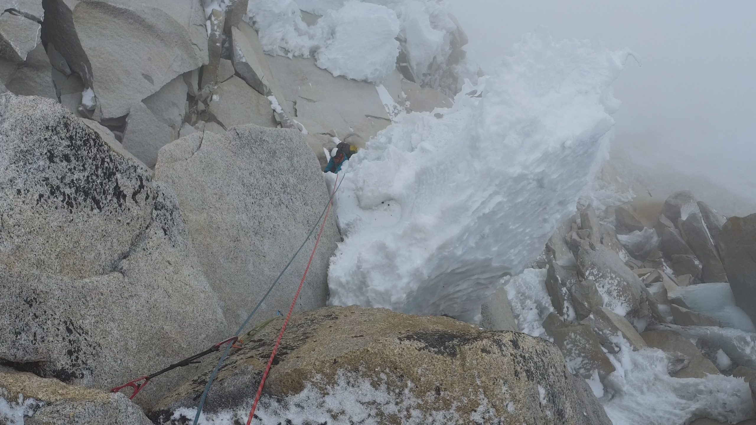
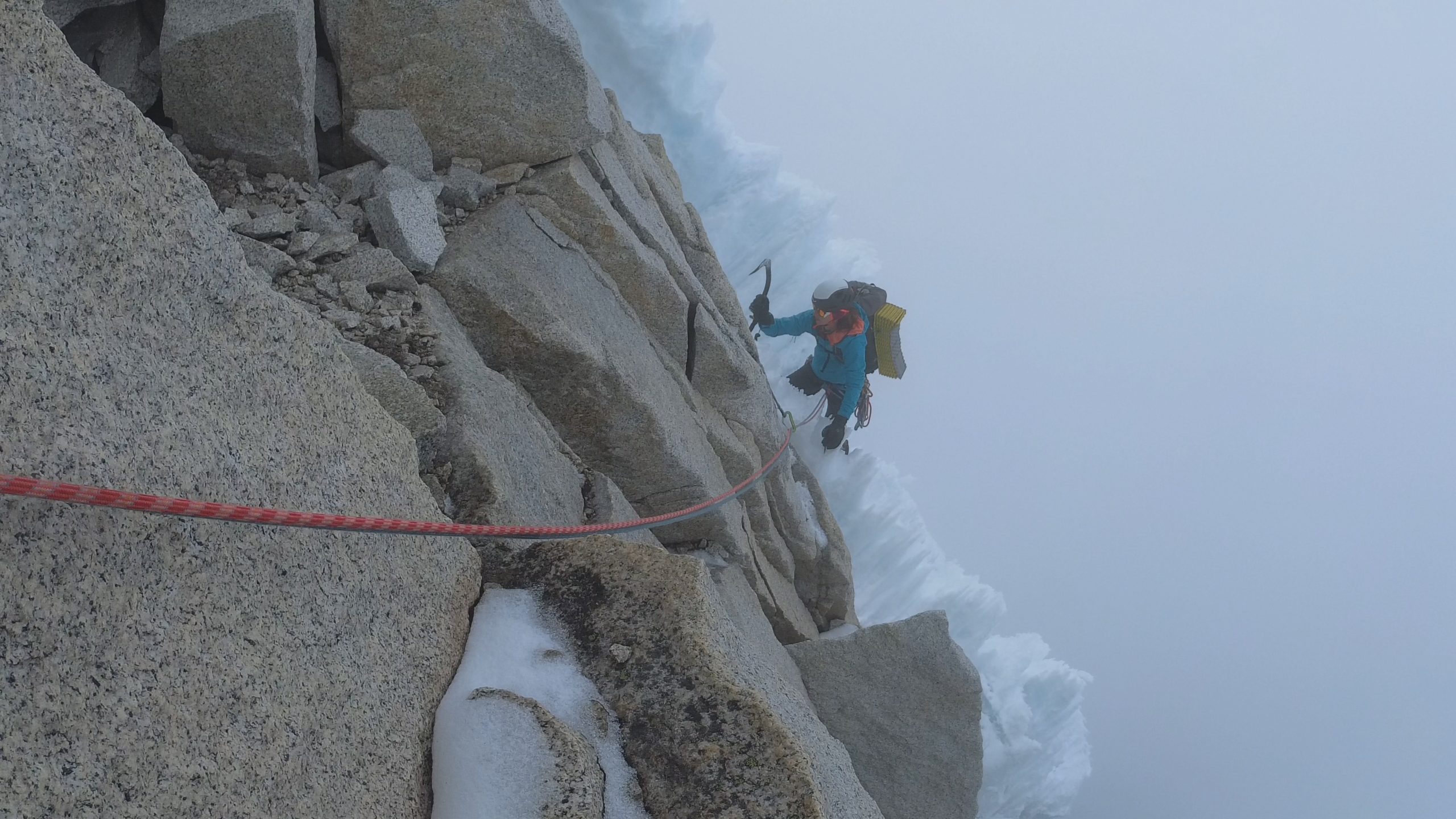
- Alternating sections of rock and ice on the second day of climbing
-
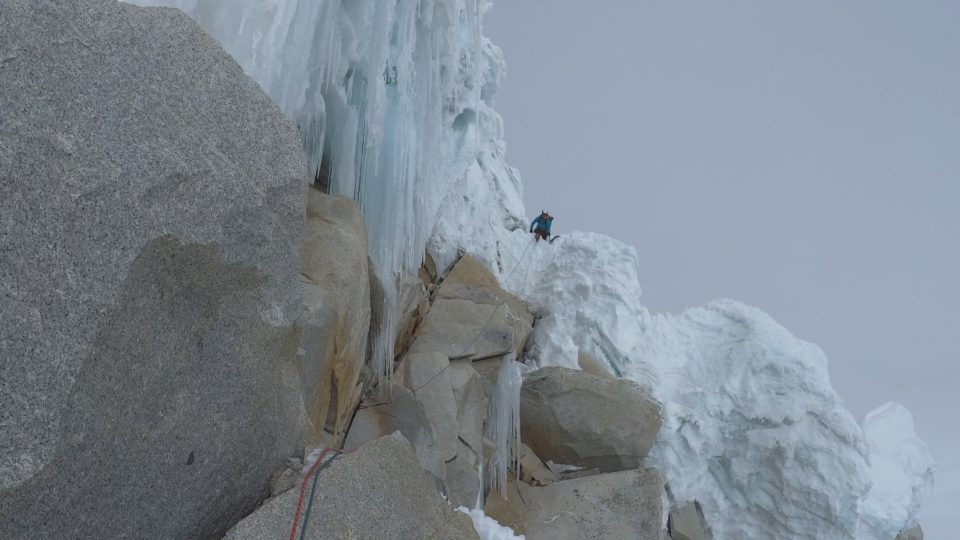
- Exit
-
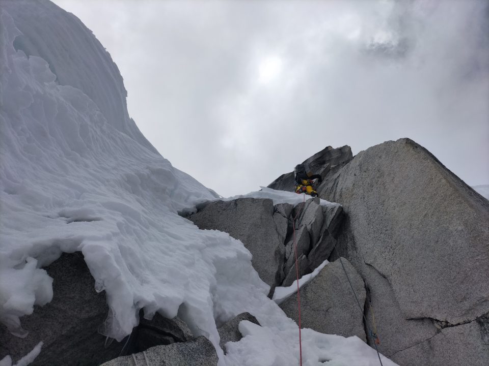
- Arriving at the second bivac
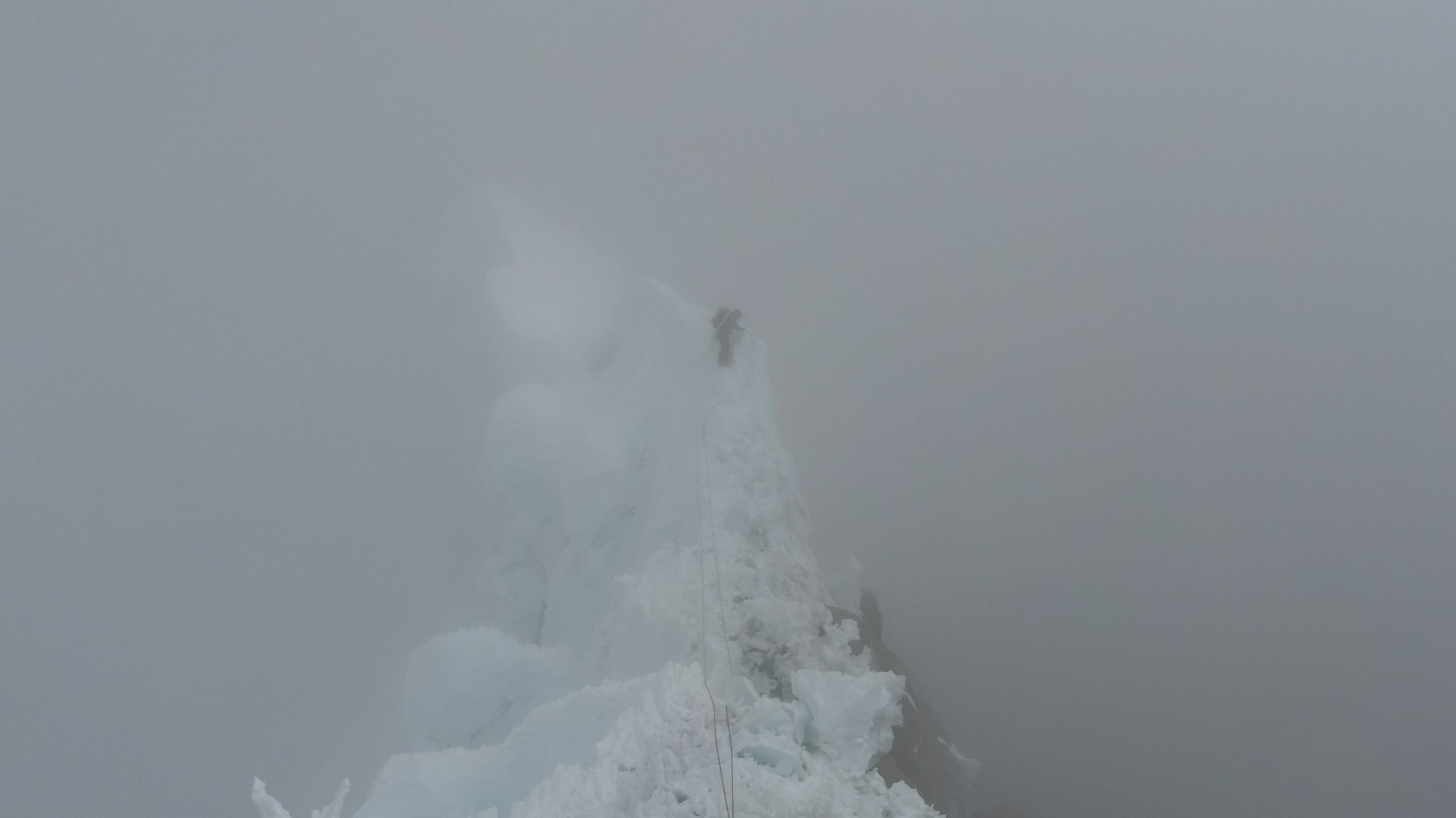
04:00h, the start-up routine begins. Melt snow, drink tea, eat some cookies, hide the bag, stuff and the harness… and around 05:00 we start climbing again. We are still surrounded by clouds, only at some point it opens enough to see a few hundred meters above us. About 100 meters before we get to the summit ridge we have to make a decision. The Argentines warned us that near here we would meet a serac that in their opinion would be dangerous to cross. They made a crossing to the left to access the summit ridge by a corridor (this route we believe coincides with a route opened in 1988 by a Canadian expedition). With the fog we can’t see the serac, but we do think we’ve located the corridor. So although we have to rappel, we have already passed the point where we should have started the crossing, we decide to choose to avoid the serac. We access the summit ridge and start looking for a place to spend the night. We will have to improvise a small platform that will not be on the snow today, this generally means a warmer bivouac. Contrary to what we would have liked, the clouds abandoned us at night although with the sun they returned to visit us. Around 12:00 on the third day of climbing we reached the top although, until about 15m before, I couldn’t sense that we were arriving because we couldn’t see beyond this distance. We had been climbing for about 7 hours on a terrain similar to that of the previous day but all the time without references of how much we had left, only with a sharp edge on which to progress, at least there was no option of making a mistake in choosing the path…
-
- On the top ridge
-
- Third day of climbing
-
- Arrival at the summit
Descent
Like everything that goes up must come down, here we go. Obviously, if the fog had accompanied us up to here, it wasn’t going to leave us now, in the most annoying moment. But the thing seems simple, if the Argentines had come down here only 10 days ago, by following in their footsteps everything would be solved. Although to follow someone’s steps you have to see them and we are able to follow the descent line for three or four rappels, about 200m. From here, as we found out later, we should leave this line of descent to head towards the SW ridge and hopefully reach the tents at the Punta Unión camp this same day. We, on the other hand, went down directly to Glacier E, which we crossed with quite some difficulty because it is very broken, and we had to spend a rather cold bivouac because our bags have accumulated so much humidity that they barely insulate us from the outside. The next day after racking our brains to see how we would get down from here, we opted for the perhaps shorter but also somewhat exposed option, although we will manage to get to our camp this time.
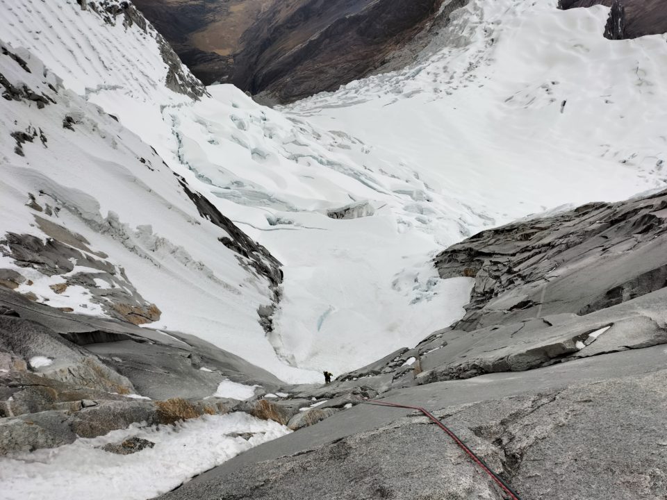
Rappelling during the descent, we had already deviated from the correct path
Bestard Top Extreme Lite
For this activity Tomeu Rubí has been using the Bestard Top Extreme Lite model from the High Mountain family, which incorporates a double boot to obtain greater insulation from low temperatures in high mountains. In addition to being a technical boot to face these climbing routes with complete solvency.

Tomeu Rubí